Travel guide to Capitol Reef National Park in Utah
♦ Routes (free): Detailed travel itineraries in USA
Capitol Reef National Park is located in south-central Utah, about a two-and-a-half-hour drive west of Moab (near Arches National Park), or about two and a quarter hours northeast of Bryce Canyon Park. These two highly popular parks attract the majority of travelers in the area, and only a minority reach Capitol Reef, which in my opinion could be much more popular if its location were different.
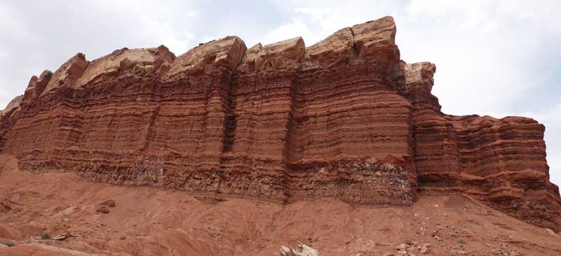
This park is named Capitol Reef because of the dome-shaped mountains, reminiscent of the Capitol dome, and the many cliffs that block land passage similar to a marine reef.
The mountain formation in the park is called the Waterpocket Fold, which is a wrinkle in the Earth's crust from tens of millions of years ago. This distortion exposed layers of rock made of different materials and colors, and their erosion over the years created unique mountain shapes in the park with many beautiful multi-colored layers.

This is a long and narrow park, stretching about 97 km from north to south and averaging about 10 km in width. Only the upper third of the park has paved access roads; the rest are dirt roads. The park is located in a desert area and is open year-round, with the peak of visitors arriving from May to September.
The park's visitor center is about 17 km east of the town of Torrey, where you can stay.
Book guided tours in Capitol Reef Park from GetYourGuide.com:
♦ Recommended Accommodations in Torrey near Capitol Reef Park
A 4-star hotel with apartments for up to 7 guests. Features a gym, sauna, jacuzzi, bar, free parking, and internet.
A 3-star hotel with a variety of rooms for up to 5 people + a child. Features a heated pool and jacuzzi. Washing and drying machines are available for guests. Free parking and internet.
Travel Itinerary including Capitol Reef
Capitol Reef Park is located between famous parks and fits perfectly into an itinerary that includes Arches and Canyonlands near the town of Moab and Bryce Canyon, which are located about two and a half hours away.
A continuation of this route east to Denver can be found in the article about Glenwood Springs, and a westward continuation to Las Vegas, including additional beautiful nature parks.
Video of Landscapes in Capitol Reef Park:
Hiking Trails in Capitol Reef Park
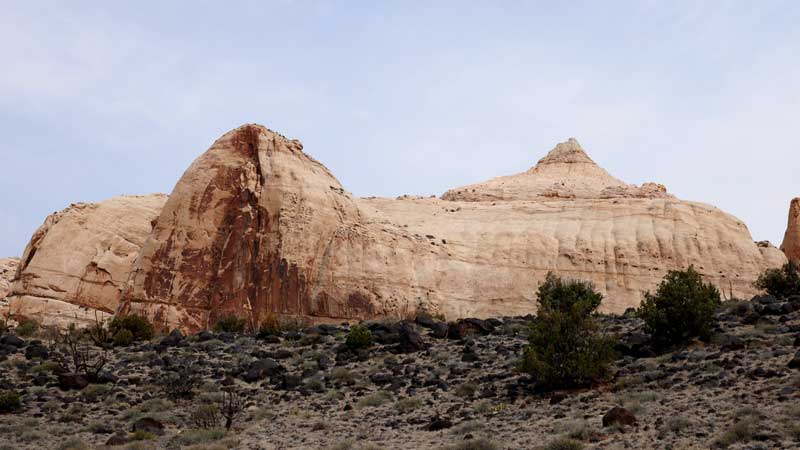
For those arriving at the park from Torrey, just before the visitor center (about 4 km), there is a viewpoint called Panorama Point from which you can see the park's cliffs from a distance.
Near this viewpoint is a dirt road about a mile long leading to another viewpoint called Goosenecks Overlook, which overlooks a bend in the canyon. Nearby is another viewpoint called Sunset Point, which is great for watching the sunset.
East of Torrey on Highway 24 is the visitor center where you should get updates on recommended trails and pick up a map.
Visitor center address: Capitol Reef National Park Visitor Center, Torrey, UT
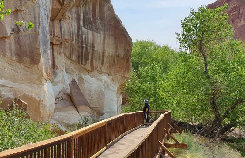
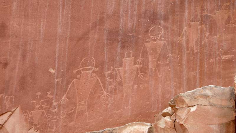
Petroglyphs Panels Trail
About 2 km east of the visitor center on Highway 24, there is a short elevated path along a rock wall where some of the rocks feature rock carvings, petroglyphs, on red rock. These include carvings of animals and people.
Near the petroglyphs are small ancient buildings, a cabin, and a schoolhouse.
Hickman Bridge Trail
From the petroglyphs, continue on Highway 24 for another 1.5 km to the trail leading to a large natural arch called Hickman Bridge.

This trail involves a significant climb of about 120 meters, but the view is worth the effort. The trail length is about 1.5 km each way. The way there is uphill and the return is downhill.
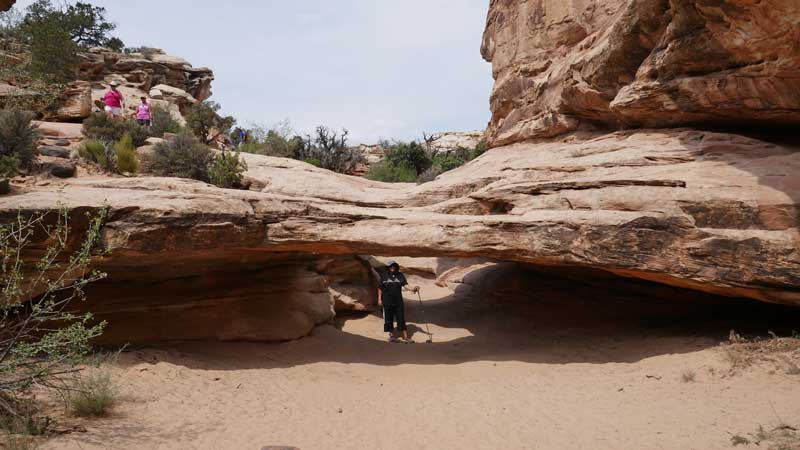
Near this trail is the mountain called Capitol Dome, after which the park is named. The entire area is at an elevation of approximately 1,800 meters above sea level.
At the arch area, the trail is circular: you enter from one side under the beautiful and giant arch, exit from the other side, and return to the original path.
Grand Wash Trail
Continue further east by car on Highway 24 for about 7 km from the visitor center to another trail called Grand Wash. This trail can be reached from two sides: from Highway 24 and from the Scenic Drive (which starts near the visitor center), from which you first need to drive about 2 km on a dirt road. It is preferable to hike it from Highway 24, where it begins right from the parking lot next to the road.

You can hike just a portion of the trail instead of the full 3.5 km each way. The most interesting part is the first 1.5 km. The trail passes through a canyon with almost vertical cliffs on both sides. At a certain point, it becomes very narrow and winding with a very impressive view. There are many holes and caves in the cliffs.
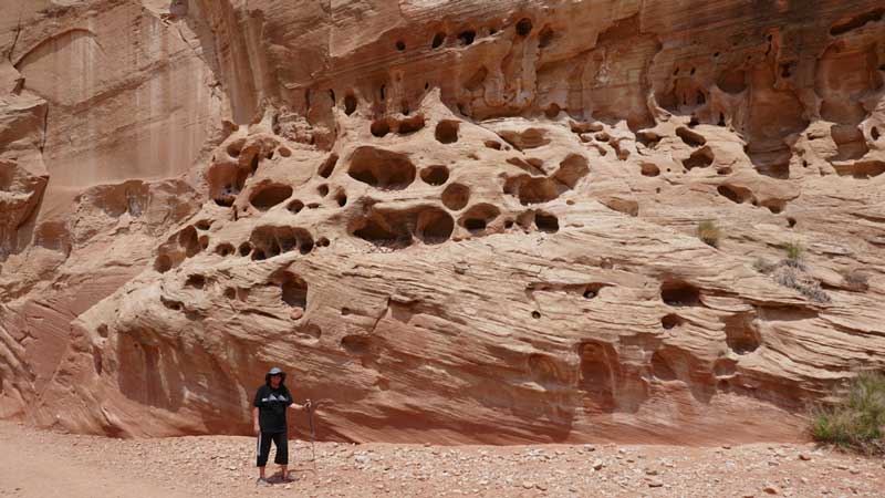
Portions of the trail feature typical desert vegetation. The trail is not difficult at all as it is almost entirely level.
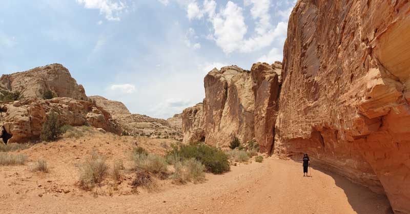
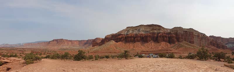
Scenic Drive
Afterwards, it is recommended to drive along the Scenic Drive. To reach it, return on Highway 24 toward the visitor center; there is a left turn to the Scenic Drive where you drive for about 45 minutes round trip. Along the way, there are stops at viewpoints overlooking colorful cliffs.


At the end of the paved Scenic Drive, there is an unpaved dirt road that can also be explored on foot or by an off-road vehicle.
Restaurants and Fuel
Torrey has a rather limited variety of restaurants, many of which are local fast food. A recommended Mexican restaurant with a variety of dishes and good service is: Chak Balam Mexican.
There is also a Subway branch where it is recommended to stock up on sandwiches (including breakfast sandwiches) for a picnic in the national park.
The town also has several gas stations. It is recommended to refuel at one of them because the surrounding area is almost deserted and uninhabited, with very few refueling options.