Trip to Alice Springs, Kings Canyon, Uluru, and Olgas
Travel itinerary: Alice Springs -> Kings Canyon -> Uluru -> Olgas -> Alice Springs.
Setting off on a flight from Brisbane to Alice Springs. Departure: 08:00, Landing: 10:50 (move clock back half an hour).
On the flight, we sat next to a female driver (in her forties) from a car rental company who transports company vehicles all over Australia. She told us about her work, which involves very long drives across the vast continent, including various experiences she had—for instance, getting stuck on the road for four days in the middle of nowhere with no one assisting her until local Aborigines saw her and somehow called for help for her. She also showed us a few photos from her trips and gave us advice regarding driving on the long and desolate roads, such as being very careful of animals crossing the roads: cows, camels, wolves, and especially kangaroos. It is most dangerous at twilight and at night. Colliding with such an animal at a speed of 130 km/h (the maximum speed permitted on most of the roads we drove on) will end in a disaster. The driver told us that various backpackers and travelers register
on the website to win the transport of rental cars from place to place for the cost of fuel expenses, insurance, and just a dollar per day rental so they can travel cheaply in Australia.
When we took off from Brisbane, we were treated to a beautiful view of the city from the window despite sitting above the wing. We immediately pulled out a camera, and here are the results.

Guided Tour
I recommend the following guided tour from Alice Springs. The tour is recommended on Viator and is also suitable for anyone who wants an experienced local guide and does not want to drive many hours themselves in the desert (as a reminder, they drive on the left side here, opposite to Israel).
♦ Transportation and a Guided tours in Uluru and Kings Canyon from the Viator website:
Description of an Independent Trip to Kings Canyon, Uluru, and Olgas
At the Alice Springs airport, we rented a car for three days.
From the airport, we drove to Alice Springs (12 km) to the tourist information center, where they advised us to set off as quickly as possible for Kings Canyon so as not to arrive in the dark. We went for a short tour around town, went up the hill (Anzac) overlooking the place, which is located close to the center. From above, you can see that Alice Springs is a small place stuck in a huge desert.

We continued touring the town's pedestrian mall, which was full of Aborigines, most of them unemployed and barefoot. Some were selling paintings.

We stocked up on drinks and a few supplies at the supermarket and set out toward Kings Canyon Resort – 465 km.
The temperature was 26 degrees, the road was a two-lane road—one in each direction, and the speed limit was up to 130 km/h. You should be especially careful of trucks with many trailers (Road Trains) and animals crossing the road, especially kangaroos. A desert road with sparse and rather monochrome vegetation. There are 3 gas stations along the way to the destination, and you must make sure to always have a tank with extra fuel. It is really not recommended to get stuck. There is also no cell reception (for all Australian companies) on the roads except inside populated areas. Fuel prices in the desert are 30 to 50 percent more expensive than in Brisbane.
We arrived at the hotel: Kings Canyon Resort, around sunset at approximately 18:00.
The room is good and well-equipped: refrigerator, kettle, iron, hair dryer, coffee/tea/sugar/milk, 2 wide beds, nightstands, table, balcony. On site, there is a restaurant, gas station, bar, and grocery store.

♦ Car rental from the reliable and convenient Booking website: Booking.com
Trip in Kings Canyon
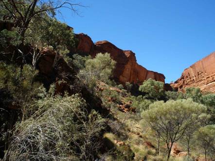
We left the hotel at 09:00 and hiked in the canyon until 13:00. We did the two recommended and marked trails. One long trail, taking three hours, along the edge of the cliffs, and a short trail of about half an hour inside the canyon.
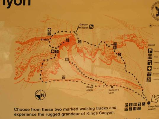
The long trail begins with a steep climb to the top of the cliff.
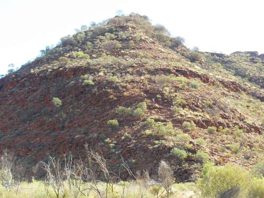
Afterward, you continue along the edge of the cliffs with relatively moderate ascents and descents. There is also a descent and ascent via stairs and a bridge when crossing to the opposite cliff. Be careful not to get close to the edge of the cliff; there are no guardrails, and if there are children—and we saw that there were—you need to watch them. Along the entire route, there are beautiful viewpoints of the canyon, the abyss, and the steep walls—some of which are completely vertical walls. At the crossing from one edge of the canyon to the other, there are stairs and a bridge.

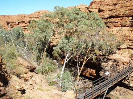
There is a little water in the canyon stream bed at the crossing point and abundant vegetation, and there is a trail leading into the stream bed at the crossing point.
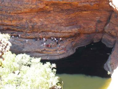
The descent from the cliff is more moderate than the ascent.
There were flies on the trip, but fewer than we expected (according to the stories and what was written in books). There were travelers who bought face nets for protection; we didn't buy any. In Uluru and Olgas, it is advisable to use a net because there are much more flies there.
After the cliff trail, we entered the canyon up to the end of the path, where there is a viewpoint into the canyon.
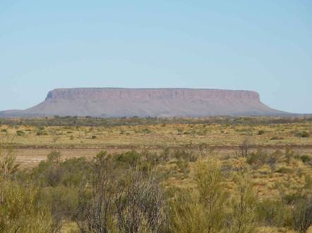
We left Kings Canyon at 15:00 toward our next hotel at Curtin Springs, which is about 200 km away. On the way, about twenty kilometers before Curtin Springs, we stopped at an organized viewpoint overlooking Mount Conner, which some travelers mistake for Uluru. It is really unclear why this mountain is not popular because it is very impressive.
Across the road from this viewpoint, there is a sand dune offering a nice view of the semi-dry lakes in the area.

We arrived at the wayside inn in Curtin Springs at 15:00. The motel's website: Curtin Springs Wayside Inn.
The surroundings of the hotel slightly resemble the Kushi Rimon roadside inn in the Negev. The place has a gas station, guest rooms, and free parking for RVs with minimal facilities. Opposite is a cattle ranch, where the cows made a lot of noise at night, and some of them wandered near the rooms. The room is quite minimal, like a simple Motel 6.
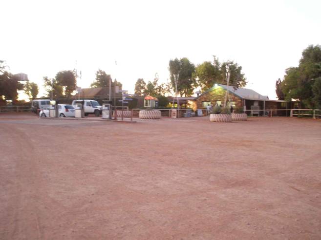
We checked in and decided it was worth driving to see Uluru at sunset (about a hundred kilometers away).
Trip to Uluru at Sunset
We left Curtin Springs at 16:00 toward Uluru, a distance of about a hundred kilometers. Before entering the Uluru/Olgas Park, an entrance fee of $25 per adult over 16 must be paid; there are no discounts. The ticket is valid for three days, including for the Olgas. You need to write your name on the ticket after purchasing.
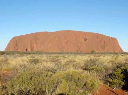
We arrived at Uluru and were awestruck by its beauty, particularly by how suddenly and toweringly it sticks out in the middle of the flat plain there, as if it doesn't belong—it looks like an upside-down boat with grooves.
First, we drove around it, and then we parked at the recommended parking area for viewing sunset. Buses have separate parking for viewing about two hundred meters further west.
You can see how the rock changes its color to a reddish tone as the sun sets, and after sunset, it changes to a red-black hue. A beautiful and impressive sight.
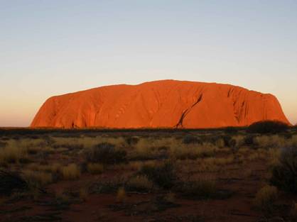
After sunset, we drove to nearby Yulara. It is a small settlement that includes several expensive hotels, a commercial center, a gas station, etc., and there is cell reception here. The supermarket was open until 21:00, and the tourist information center until 20:30. We bought groceries at the supermarket, including ice for the cooler.
We drove back, about 90 km, in the dark at a slow speed of about 80 km/h out of fear that animals might appear in our path; we only saw one kangaroo. In all our drives through the Northern Territory, we saw many roadkill animals on the sides of the roads, mostly kangaroos.
Day Trip in Uluru
Departure from the motel at 08:00 to Uluru. Starting with a visit to the cultural center located near the mountain. The center has displays, movies, and many nice posters with explanations of Aboriginal culture (photography is forbidden there). We read some of the text casually and looked at the paintings there, most of which consist of animal and human drawings made by dots in various colors. There is also a very expensive souvenir shop on site; every painting costs hundreds of dollars.
We spent only about twenty minutes there, but you could spend more time there.
We first drove to the sunrise viewpoint – a less optimal location than the sunset one; it is too close to the rock and not suitable for photographing the whole mountain. Also, the site is low, and there were bushes and trees interfering with a good view of the mountain.
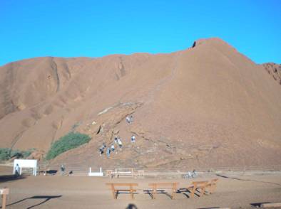
We continued driving to the main parking area near the mountain climb point. Yesterday, we saw people climbing it, but today climbing was forbidden due to high winds at the summit. The climbing trail is very steep and dangerous, with a single rope railing to hold onto. It seems very inadvisable to climb. The place is also sacred to the Aborigines, and they prefer people not to climb the rock.
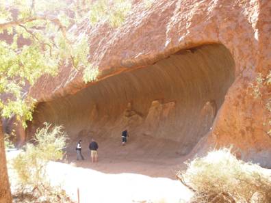
We hiked on foot around the western part of the mountain, saw several wall paintings, caves, waterholes, and various shapes and hollows on the surface of the impressive rock.
There were many flies accompanying us like a cloud; we regretted not buying face nets because they get into every opening on your face—a real nuisance—one of us swallowed a repulsive fly.
We hiked there for about two hours before heading out to tour the Olgas, located about 50 km away.
Trip to the Olgas (Kata Tjuta)
On the way from Uluru to the Olgas (about 50 km), there is a viewpoint toward the Olgas at a distance of 26 km from it. To our surprise, the viewpoint was on an elevated and shaded platform (unlike all previous viewpoints so far).
The Olgas mountains consist of a series of steep hills, even higher than Uluru, and some say they are more impressive and beautiful. From this viewpoint, they were not more impressive than Uluru, likely due to the distance.
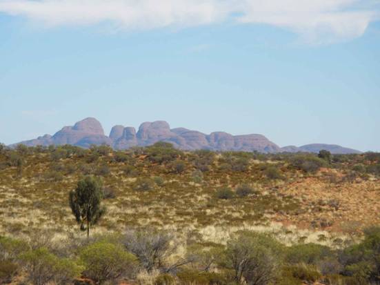
When we got closer and moved to their other side, they were revealed in all their beauty.
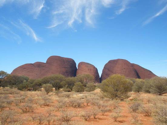
As you can see, the place consists of separate domes, very steep and high. There is an organized walking trail between the domes that is 7.5 km long. We hiked its entire length for about three hours and were impressed by the view between these mountains. The place is no less interesting than Uluru because it is diverse, and you can hike a lot inside it. At Uluru, you walk around it once, and there isn't much more to do except see it at sunset.
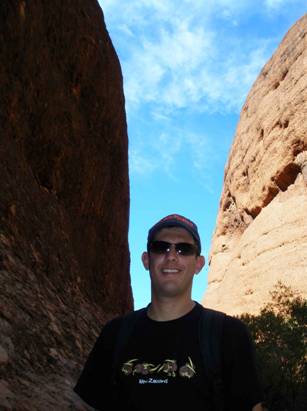
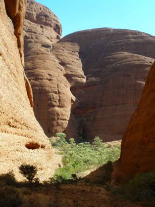
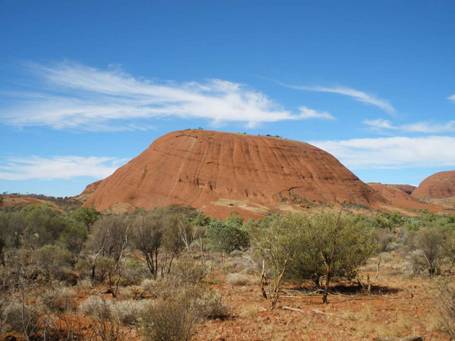
From there, we drove to Yulara to eat—quite expensive, well, it's almost the end of the world. We hurried back to the hotel in Curtin Springs before dark, arriving at sunset.
Drive Back to Alice Springs and a Short Tour of the Town
We left the motel at 07:30 toward Alice Springs, a distance of 360 km. We made the drive in about three hours.
On the desert roads, there is signage indicating if there is a fence against animals, but the fence is not very effective against kangaroos, which are capable of jumping over it. The fence is good against cows, and there are cows. Every two or three kilometers, there is animal carcass, mostly kangaroos.
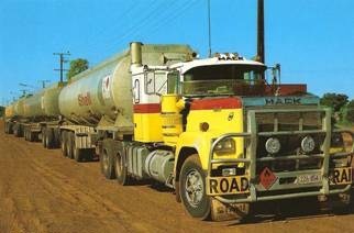
The roads are generally suitable for fast driving, but as mentioned, you must beware of animals and long trucks called "Road Trains." These are large trucks with 3 to 4!! long trailers transporting fuel, minerals, food, containers, etc. When passing them, you must keep your distance because a slight drift by the truck driver causes a large drift in the last trailer, and sometimes the road shoulders are narrow and broken. Sometimes there is an extra lane for passing, and if not, you can pass them because the road is usually straight for many kilometers with little traffic.
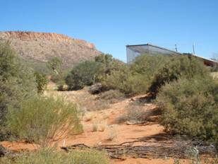
We began our visit to Alice Springs at the Desert Park near the town.
The park covers a relatively large area, full of desert vegetation. Inside the park, various pavilions are scattered with cages containing typical desert animals, mainly birds.
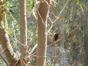
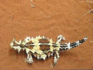
There is also a large and impressive pavilion for nocturnal animals, where you can see snakes, lizards, reptiles, and various rodents.
There is an enclosure with several kangaroos lying in the shade under the bushes.

At many points in the park, it is noted that guided tours are available at specific times, each time on a specific topic.
There is also a cinema hall showing a movie about the formation of Australia, and at the end, there is a large picture of a mountain in the desert on the screen; then the screen lowers, revealing the actual mountain located next to the park behind it—impressive.
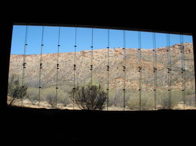
You can spend between two and three hours in the park.
For those interested, you can also go on a camel ride tour in the desert near the city. Here is a short video from such an experience we had on another trip in Alice Springs:
Camel tour in Alice Springs
From the park, we drove to the town center, spent time at an internet cafe, ate lunch at a cheap Thai restaurant in the pedestrian mall, looked around souvenir shops, bought a few things, refueled, and drove to the airport. We returned the car at 15:30.
The flight to Darwin departed at 17:00, and we landed in Darwin after a two-hour flight. You can read about the trip there in the article
Trip to Darwin and Parks in the Top End of the Northern Territory.